
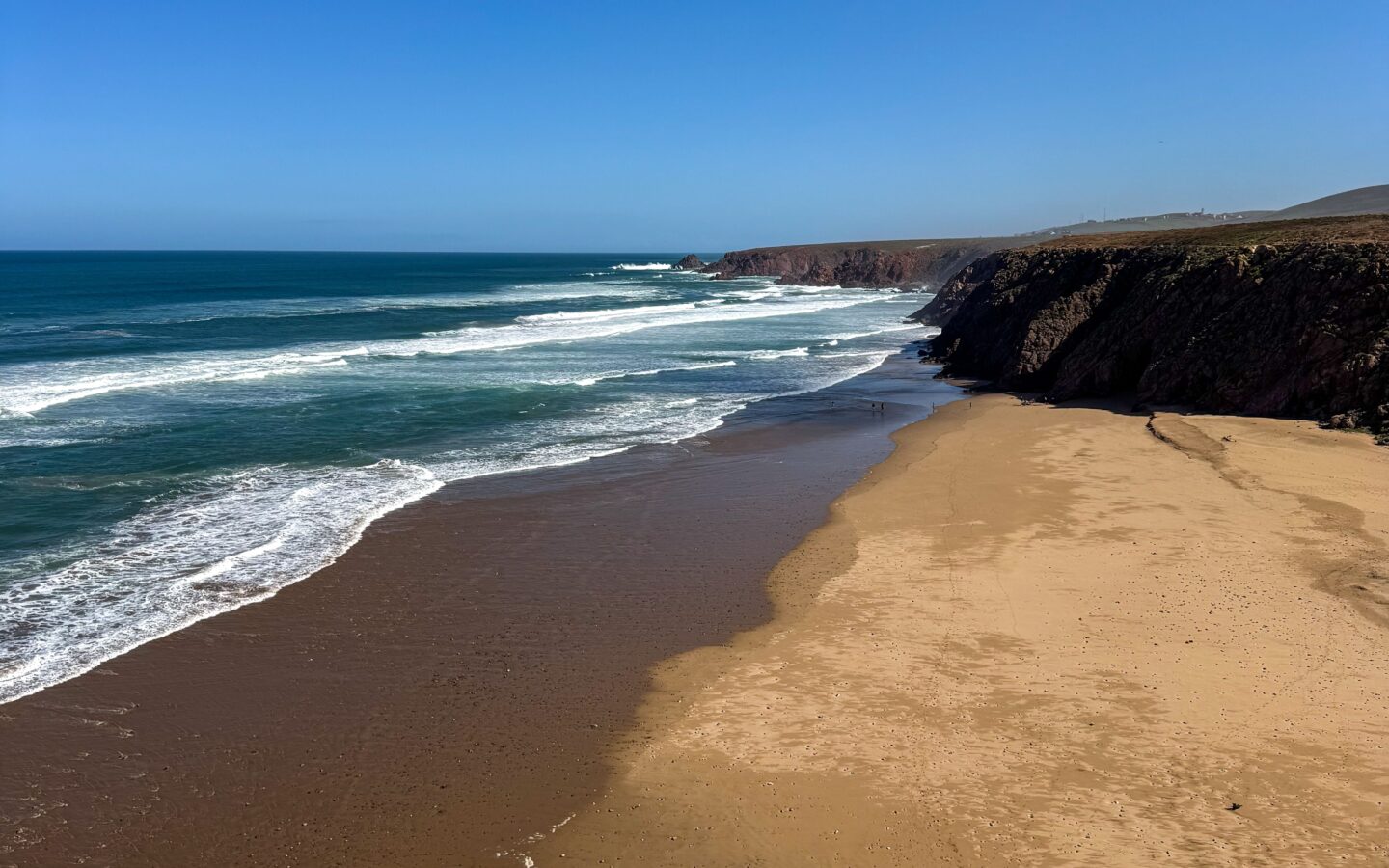
The best first beach in Mirleft is Imin Turga for space and a straightforward introduction to the coast; choose Aftas for a smaller cove, Tamhrouchte for wild scenery and Legzira for a tide-planned day trip. None is reliably “best for swimming”: this is an exposed Atlantic coastline, and swell, current, tide and cliff conditions can change quickly.
Mirleft’s beaches differ sharply in access, shelter and atmosphere. Choose by what you want to do rather than by a “best beach” ranking, and check access, seasonal services and lifeguard cover on the day.
Mirleft beaches at a glance
- Best first stop: Imin Turga, the broad main beach below Mirleft.
- Best smaller cove: Aftas, close to town and shared with local fishing activity.
- Best for raw scenery: Tamhrouchte / Plage Sauvage—visit for the landscape, not a promise of safe swimming.
- Best landmark excursion: Legzira, where one red sandstone arch remains; plan around the tide and keep clear of cliffs.
- Best town-and-beach day: Sidi Ifni, combining its seafront with cafés and architecture above the coast.
- Without a car: start with Imin Turga or Aftas; remote coves are easier with arranged transport and verified access.
Which Mirleft beach should you choose?
Approximate distances below use central Mirleft as the reference and are only planning aids. Road works, track condition and the exact start point can change the journey. “Access” describes the general character, not a guarantee of step-free or all-weather access.
| Beach | Approx. from Mirleft | Choose it for | Know before you go |
|---|---|---|---|
| Imin Turga / Imi Ntarga | About 1 km | First visit, long walk, sunset, watching surf | Established descent from the plateau; exposed surf and currents still vary |
| Aftas | About 1–2 km | Smaller cove, fishing atmosphere, a slower afternoon | Boats use the beach; cafés and other services can be seasonal |
| Marabout / Sidi Mohammed Ben Abdellah | About 2–3 km | Rock formations, coastal landscape and cultural context | Respect the shrine and local visitors; rocks and swell need care |
| Tamhrouchte / Plage Sauvage | About 4 km | Wild cliffs, photography and experienced surf observation | More exposed; check track, cliff and ocean conditions locally |
| Sidi El Wafi and Ftaissa | Roughly 7–10 km | Space, remote scenery and a quiet coastal outing | Do not assume facilities, easy access, phone signal or supervision |
| Legzira / Lagzira | About 22 km south | Red cliffs, the remaining arch and a long beach walk | One arch collapsed in 2016; rising tide and rockfall are real hazards |
| Sidi Ifni town beach | About 30–35 km south | Combining the coast with a town visit | Urban setting does not make Atlantic conditions safe |
| Aglou | About 40–45 km north | Broad coast, promenade and a Tiznit-side day trip | Longer outing; check wind, water and seasonal services |
The useful answer
If you have one beach afternoon, go to Imin Turga. If you want a smaller cove near town, choose Aftas. If you want a scenic day trip, combine Legzira with Sidi Ifni after checking the tide. Save remote beaches for daylight, reliable transport and current local access information.
Imin Turga: Mirleft’s main beach
Imin Turga—also written Imi Ntarga, Imin Tourga or simply Mirleft Beach—is the broad sandy beach most visitors see first. It lies below the village plateau between ochre cliffs and has an established descent from above. The open sand makes it useful for a long walk, watching the sunset and observing surfers from shore.
Its convenience should not be mistaken for calm water. Imin Turga faces Atlantic swell, and its sandbanks, shorebreak and currents change. On a calm day it may look inviting; on a larger day the same beach can be powerful. Check local flags and advice, watch the water before entering and do not assume lifeguard coverage.
Aftas: a smaller cove close to town
Aftas sits in a tighter cliff-backed cove and feels more intimate than Imin Turga. Fishing boats are part of the working beach, and simple places for food or tea may operate nearby. That combination makes Aftas attractive for a slow afternoon, but opening times and facilities should be treated as seasonal until checked.
Leave clear access around boats, ropes and equipment. The cove shape can create an impression of shelter, yet waves, rocks and current still depend on the day. Choose a viewpoint above the water when conditions are rough rather than trying to turn every beach visit into a swim.
Marabout Beach: landscape and living culture
Often called Marabout Beach or Plage Sidi Mohammed Ben Abdellah, this stretch is identified by a white shrine above the coast and distinctive rock formations. It is a place to appreciate both landscape and local religious context—not simply a photo prop. Dress and behave respectfully around the shrine, do not enter private or sacred space without invitation and ask before photographing people.
For the beach itself, check tide and surf before walking close to rocks. Wet surfaces, wave run-up and falling material near cliffs can turn an easy-looking route into a poor choice.
Tamhrouchte: the wild-beach option
Tamhrouchte, frequently labelled Plage Sauvage, is the open, cliff-backed choice for travellers who want Mirleft’s rougher Atlantic landscape. It is exposed to swell and associated with surf, caves and red rock scenery. Visit for scale, photography and a walk only when tide and access allow.
Do not enter caves or linger beneath overhangs. Check the approach before committing to a track, especially after rain or coastal works, and leave enough daylight to return. This is not a beach to choose because someone online called it “hidden” or “empty.”
Sidi El Wafi and Ftaissa: remote coast, more uncertainty
Beaches farther from the village appeal to travellers looking for open space. They also remove many of the safety nets of a town beach. Track condition, parking, mobile signal, shade, drinking water and seasonal services should all be treated as unknown until confirmed locally.
Go in daylight with a charged phone, offline map, water and a clear return plan. Tell someone where you are going. If the access looks damaged or crosses private or working land, turn around rather than creating a new path.
Legzira: the arch beach south of Mirleft
Legzira—also written Lagzira—is the standout landscape excursion between Mirleft and Sidi Ifni. Red sandstone cliffs rise above a long beach, and one large natural arch remains in the surf zone. Older images often show two arches; one collapsed in September 2016. Do not plan the visit around recreating an outdated photograph.
The walk toward the arch depends on the tide. High water can narrow or cut off sections at the foot of the cliffs, while low tide gives more sand but does not make eroding rock safe. Check a tide table on the day, ask locally, turn back early as the water rises and keep clear of the arch, overhangs and cliff base.
Atlantic beach safety
- No beach is always safe for swimming. Ask for current local advice and stay out when swell, current or visibility is poor.
- Never assume lifeguards are present. Confirm any supervised area and hours on the day.
- Watch for rip currents. Darker channels, fewer breaking waves or water moving seaward can indicate a current; if unsure, do not enter.
- Keep away from cliffs and caves. Erosion and rockfall continue even in calm weather.
- Check the tide twice: once before leaving and again at the beach. Low tide is not a safety guarantee.
- Keep children within arm’s reach near the water. Do not rely on the labels “family beach” or “sheltered cove.”
- In an emergency, alert people nearby and contact local services. Confirm the current numbers with your accommodation and save them offline.
Sidi Ifni and Aglou: two different coast days
Sidi Ifni: beach plus town
Sidi Ifni works when not everyone in the group wants a full beach day. Combine the broad coast below town with cafés, viewpoints and the city’s Spanish-period architecture. The town setting adds services nearby, not a guarantee of gentle sea conditions. Legzira and Sidi Ifni fit naturally into one southbound day if the tide, daylight and transport work.
Aglou: north toward Tiznit
Aglou offers a broader seaside setting on the Tiznit side of Mirleft, with a promenade and fishing-coast character. It makes sense as part of a northern route rather than a quick extra stop after Legzira. Check wind and visibility before committing to the drive, and combine it with Tiznit only if the day remains relaxed.
Getting around the beaches
Walking can work for Imin Turga and Aftas depending on where you stay, your footwear and the heat. For Marabout, Tamhrouchte and remote coves, ask about the current approach before setting out. A local taxi or accommodation transfer avoids rental-car logistics; agree on the pickup point, return time and fare before the driver leaves.
A rental car gives the most flexibility for Legzira, Sidi Ifni and Aglou. Use the getting to Mirleft guide to compare transport. If your beach choice depends on waves, read the Mirleft surf guide before treating a beach label as a condition report.
A low-impact beach day
- Carry out every item you bring; do not depend on a bin at remote beaches.
- Use established paths and avoid widening tracks across fragile slopes.
- Keep clear of fishing boats, nets and working areas.
- Ask before photographing people and respect religious sites.
- Do not collect rock, plants or cultural objects.
- Choose reusable water bottles and containers; wind quickly carries light plastic into the Atlantic.
Frequently asked questions
What is the best beach in Mirleft?
Imin Turga is the most useful first choice for a broad beach and long walk. Aftas suits a smaller-cove afternoon, while Tamhrouchte is better for wild scenery. The best option changes with tide, wind, access and what you want to do.
Can you swim at Mirleft’s beaches?
Swimming may be possible in suitable conditions, but no beach is safe every day. Check local advice and flags, confirm supervision, and stay out during strong swell, current or poor visibility.
Are there still two arches at Legzira?
No. One of the best-known arches collapsed in September 2016, and one remains. Keep a safe distance from the remaining arch and cliff base because erosion continues.
Can I see Mirleft’s beaches without a car?
Yes. Imin Turga and Aftas can be reached on foot or by short local transport from many parts of town. Use a taxi, arranged driver or rental car for more distant beaches, and agree on the return before setting off.
Which Mirleft beach is best with children?
No beach should receive a blanket family-safety label. Choose the calmest currently supervised area after local advice, keep children within arm’s reach and have a land-based alternative if the Atlantic is rough.
Do the beaches have toilets, cafés and parking?
Facilities vary by beach and season. Imin Turga, Aftas, Legzira, Sidi Ifni and Aglou generally have more visitor infrastructure than remote coves, but verify current opening, parking and toilet access before relying on it.
Sources
Distances are approximate. Facilities and safety services vary by season, so check what is available when you arrive.
- Moroccan National Tourist Office: Morocco beach guide — Mirleft’s setting between cliffs and wild beaches.
- Moroccan National Tourist Office: Atlantic and surf guide — Mirleft’s beaches, cliffs and surf context.
- Magical Mirleft: regional beach directory — beach names, relative locations and coast orientation, independently cross-checked where possible.
- European Geosciences Union Imaggeo: the collapsed Legzira arch — dated visual record of the September 2016 collapse.
- Sidiifni.org: Legzira access and tide guide — current visitor context; independent, not an official tourism authority.
- Morocco High Commission for Planning: Mirleft commune monograph 2024 — official administrative context.